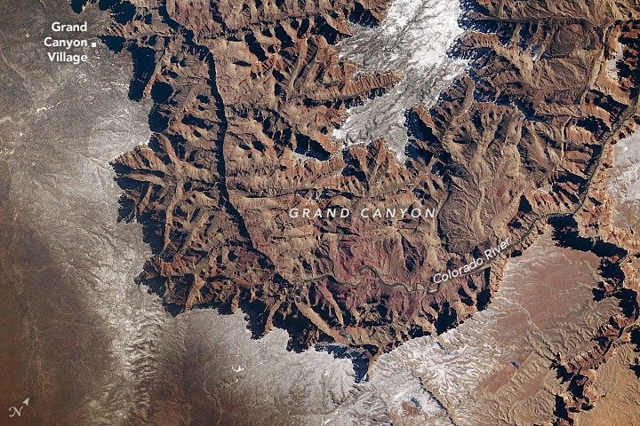
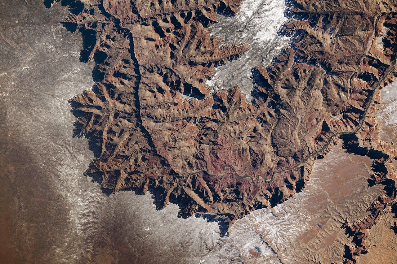
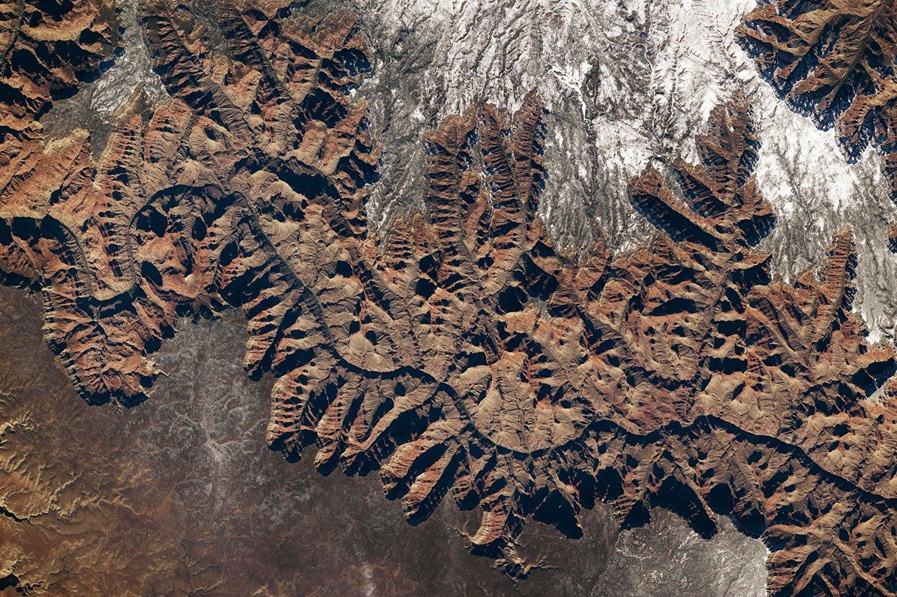
A sunny day in early 2026 revealed the remnants of a winter storm on Arizona’s high desert—and produced a striking, if somewhat puzzling, display of light and shadow in the Grand Canyon. An astronaut aboard the International Space Station captured these photographs of the distinct topography on January 26, 2026.
Snow flurries were flying in the area the previous two days, as they were across much of the central and eastern U.S. Hazardous conditions within Grand Canyon National Park prompted officials to close Desert View Drive, which runs along a portion of the South Rim shown in the photo above, and to issue warnings about icy trails. (The North Rim is closed to traffic in winter and early spring.) When the road reopened around the time of these photos, a layer of white remained on both the South Rim, at an elevation of around 7,000 feet (2,100 meters), and the North Rim, at about 8,000 feet (2,400 meters).
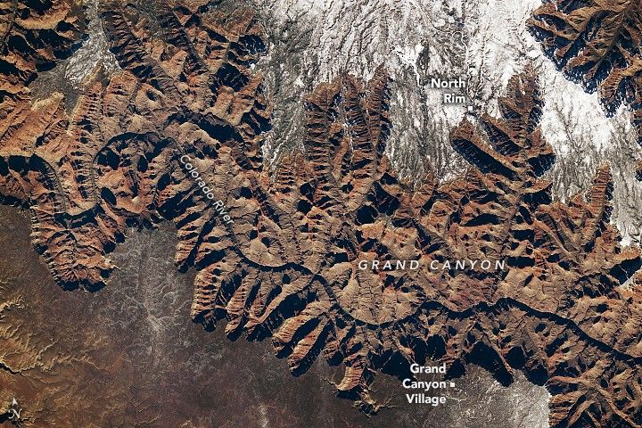
Snow is typical at these high elevations in winter. The South Rim and North Rim see average season totals of 58 inches and 142 inches, respectively. At lower, warmer elevations, precipitation tends to fall as rain. On January 24, for example, snow fell on the plateau, while a weather station at Phantom Ranch on the canyon floor recorded 0.06 inches of rain.
If these photos make the iconic feature of the American West look more like a mountain range than a vast chasm, the effect is likely due to a visual illusion called relief inversion. Many people have an unconscious expectation that a light source should come from the top of an image. In these images, however, the Sun is shining from the south, or the bottom of the photos. Though the shadows on the canyon walls may be visually deceiving, the presence of snow helps to signal that the flat areas sit at higher elevations.
Astronaut photographs ISS074-E-208838 and ISS074-E-208848 were acquired on January 26, 2026, with a Nikon Z9 digital camera using a focal length of 400 millimeters. They are provided by the ISS Crew Earth Observations Facility and the Earth Science and Remote Sensing Unit at NASA Johnson Space Center. The images were taken by a member of the Expedition 74 crew. The images have been cropped and enhanced to improve contrast, and lens artifacts have been removed. The International Space Station Program supports the laboratory as part of the ISS National Lab to help astronauts take pictures of Earth that will be of the greatest value to scientists and the public, and to make those images freely available on the Internet. Additional images taken by astronauts and cosmonauts can be viewed at the NASA/JSC Gateway to Astronaut Photography of Earth. Story by Lindsey Doermann.
References & Resources
- Grand Canyon National Park (2025, November 28) Visiting Grand Canyon During Winter. Accessed February 6, 2026.
- Grand Canyon National Park (2025, February 18) Weather and Climate. Accessed February 6, 2026.
- NASA Earth Observatory (2019, March 10) Grand Canyon Under Snow. Accessed February 6, 2026.
- NASA Earth Observatory (2013, April 20) Exploring the Grand Canyon. Accessed February 6, 2026.
- NASA Earth Observatory (2011, July 12) Are you ever fooled by relief inversion? Accessed February 6, 2026.
You may also be interested in:
Stay up-to-date with the latest content from NASA as we explore the universe and discover more about our home planet.

The colorful formations found in this bowl-shaped escarpment in southwestern Utah are the centerpiece of Cedar Breaks National Monument.
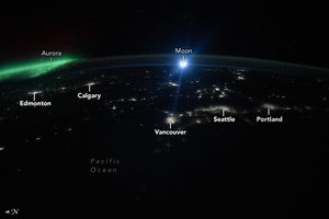
The glow of city lights, the aurora, and a rising Moon illuminate the night along the northwest coast of North…

An astronaut captured a moonrise—and much more—in a series of photos taken from the International Space Station.


