3 min read
Sols 4461-4463: Salty Salton Sea?

Earth planning date: Friday, Feb. 21, 2025
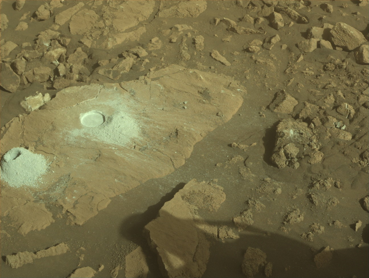
Since first encountering the sulfate-bearing unit around Sol 3540, we have detected minerals and elemental concentrations consistent with the presence of various salts and a general drying out of Mars climate (read ”NASA’s Curiosity Mars Rover Reaches Long-Awaited Salty Region”). Salton Sea in California is a saline lake, meaning it has high concentrations of salty minerals formed as a result of evaporation processes dominating over input of fresh water. As such, we thought it would be a fitting name for one of our rock targets to be analyzed by the APXS and MAHLI instruments in this weekend plan. We have observed a variety of different textures and colors associated with the sulfate-bearing unit. The target “Salton Sea” is an example of one such texture — a dark-toned, relatively smooth, platy layer. Will the chemistry indicate the presence of salty minerals, some of which may be the same as those found at Salton Sea? Other rock targets to be analyzed in this busy weekend plan include “Wellman Divide,” another APXS and MAHLI target on a thicker, dark-toned, rougher textured layer, and “Goodykoontz” and “Paseo del Mar,” both ChemCam LIBS targets, on a nodule and a dark, platy layer, respectively.
We also continue to document the layers of rock exposed within several buttes and mesas around us (“Dragon Tooth” and “Texoli” buttes, and “Gould Mesa”) with CCAM RMI and Mastcam imaging. Curiosity will hopefully climb though equivalent layers as we continue our ascent of Mount Sharp, so these images can help with interpretation when we finally encounter them on the ground. Mastcam will also image a trough in the sand surrounding one of the bedrock blocks — a feature that has been observed relatively frequently lately.
The atmospheric scientists also have an action-packed plan with coordinated APXS atmospheric and ChemCam passive-sky observations to measure argon and oxygen, respectively, as well as standard activities. These observations help to track changes in seasonal atmospheric flow from equatorial to polar regions on Mars. Standard atmospheric monitoring activities included in the plan are: Navcam dust devil movies (x2), suprahorizon movies (x2), a zenith movie, line of sight observations (x2), and a cloud altitude observation, as well as Mastcam tau observations (x2).
After a planned drive of about 49 meters (about 161 feet) on the second sol of this three-sol weekend plan, the MARDI camera will take an image of the terrain beneath the rover. The plan is rounded out with standard REMS, DAN and RAD activities.
Written by Lucy Thompson, Planetary Geologist at University of New Brunswick


