NASA Data Powers New Tool to Protect Water Supply After Fires
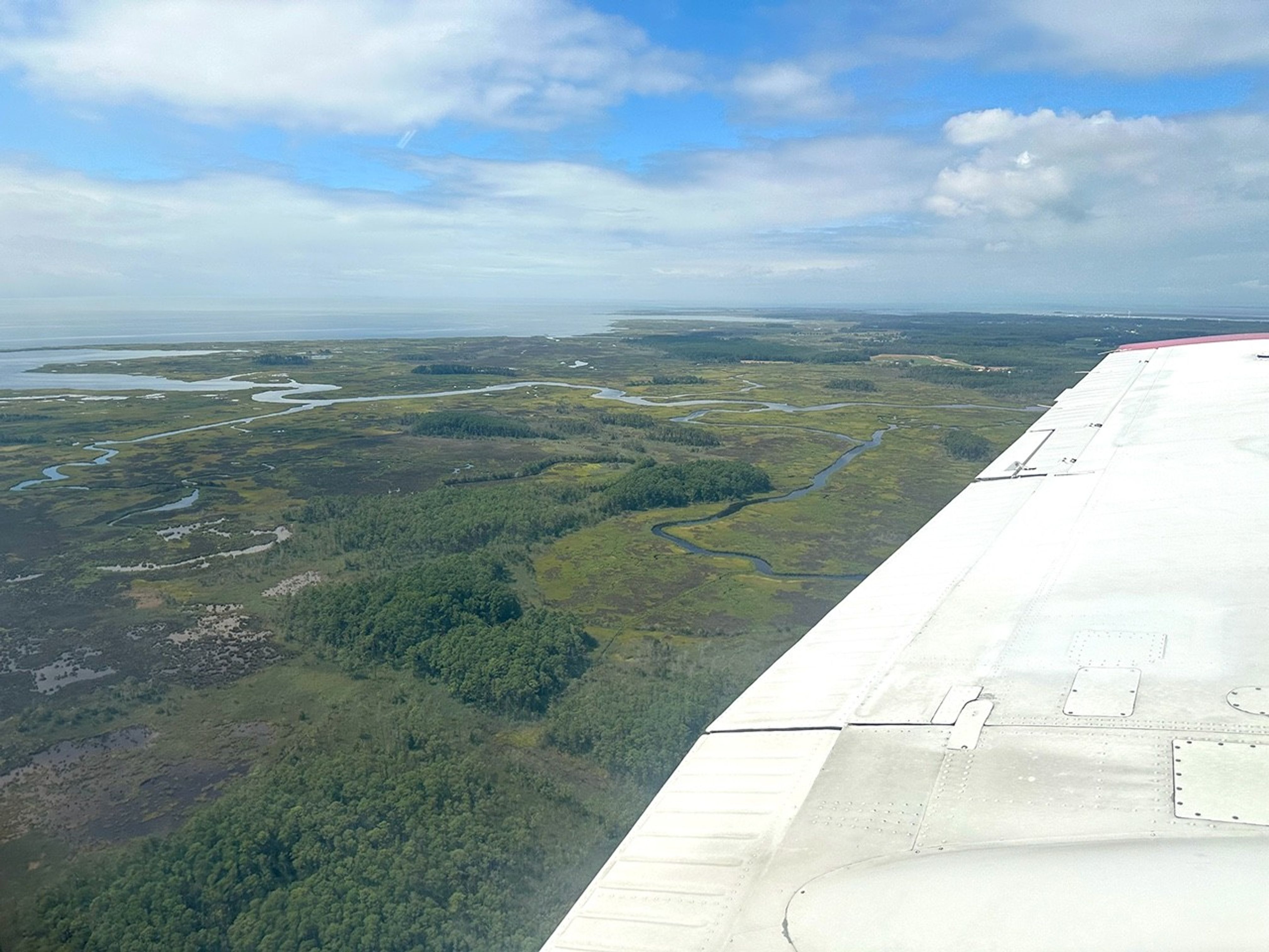
USFS/Cecilio Ricardo
When wildfires scorch a landscape, the flames are just the beginning. NASA is helping communities across the nation foresee and prepare for what can follow: mudslides, flash flooding, and contaminated surface water supplies.
A new online tool called HydroFlame, built with support from NASA’s Earth Science Division, relies on satellite data, hydrologic modeling, and artificial intelligence to predict how wildfires could affect water resources, from tap water to the rivers and streams where people fish. The project is being developed with the University of Texas at Arlington, Purdue University, the U.S. Geological Survey, and other partners.
For now, the tool includes data only for Montana’s Clark Fork Basin, where it is being piloted. But new applications are underway in California and Utah. Researchers will soon begin fieldwork in Los Angeles County to collect on-the-ground data to refine HydroFlame’s predictive approach — an important step toward expanding it beyond the pilot site.
“As wildfires intensify across the country, so do their ripple effects on regional water resources,” said Erin Urquhart, program manager for NASA’s water resources program at NASA Headquarters in Washington. “HydroFlame could help communities in the U.S. see what’s coming and plan for it, before a fire becomes a water crisis.”
That kind of foresight is exactly what local officials are looking for.
“For someone managing a trout fishery or drinking water supply, knowing when a stream might be overwhelmed with debris after a fire can mean the difference between preparedness and a crisis,” said Morgan Valliant, who is part of the project’s advisory group and the associate director of ecosystem services for Missoula Parks and Recreation in Montana. “This tool could let us move from reacting to planning.”
When fire reshapes land
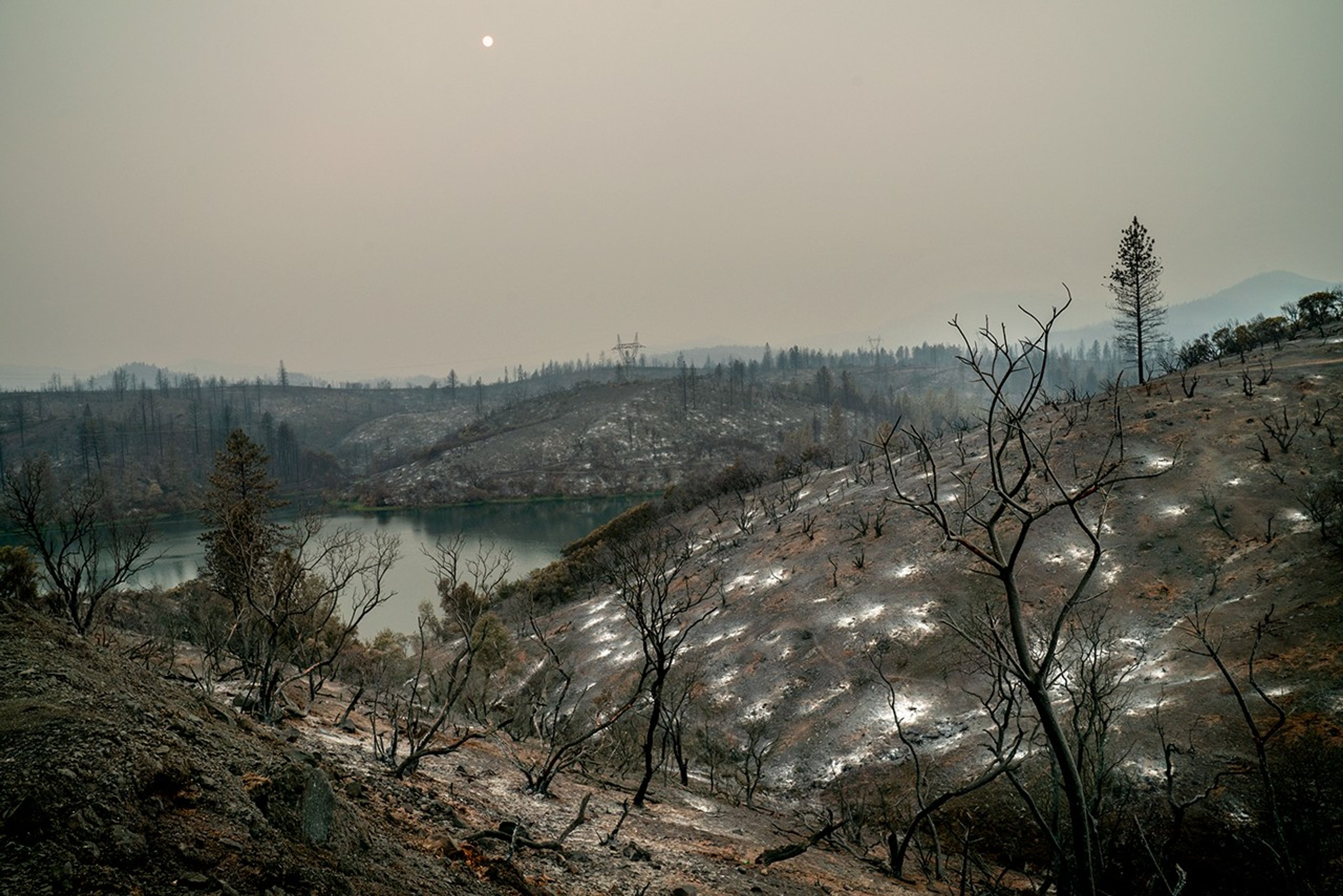
In the wake of a wildfire, charred hillsides are often unstable. With the protective blanket of plants burned away, rain that once soaked gently into the soil can race downhill, sending ash, debris, and sediment into rivers and reservoirs. That runoff can trigger flash floods and contaminate drinking water.
Severe wildfires can also bake soil into a water-repelling crust. With less absorption, the same slopes can swing from drought to destructive floods, and those runoff risks can persist for decades.
HydroFlame, developed by a team led by Adnan Rajib at the University of Texas at Arlington, is built to anticipate those extremes.
“NASA is constantly pushing the boundaries when it comes to sensing and predicting fire,” Rajib said. “But there is still a huge gap when it comes to translating that fire information in terms of water. That’s where HydroFlame comes in.”
The tool will include three components:
- a historical viewer that maps past fire impacts on streamflow and sediment
- a “what-if” scenario builder to simulate future fires
- a predictive tool that generates weekly forecasts using near-real-time satellite data as initial conditions
When a wildfire is identified, the tool will identify how severely areas are burned across watersheds and track shifts in vegetation, soil wetness, and evapotranspiration, or the release of water from the land and plants to the atmosphere. HydroFlame uses data from satellite missions and instruments including MODIS (Moderate Resolution Imaging Spectroradiometer), Landsat, and SMAP (Soil Moisture Active Passive).
Those observations, combined with stream records from gauged rivers, feed into simulations of possible fire-driven changes in water flow and quality. A machine-learning component will fill in where gauges are absent, making it possible to predict impacts up to two weeks in advance.

The historical viewer, which is publicly accessible, lets users explore how past fires altered streamflow and sediment levels across the basin. The other components are still in development: The prototype of the “what-if” scenario builder tool is expected to launch in December 2025, with the full version planned for May 2026.
HydroFlame’s ability to capture compounding factors — drought before a fire, flooding afterward — and simulate their cascading effects on water systems is what makes it different from other tools, Rajib said. “Many traditional models treat each fire as a one-off,” he said. “HydroFlame looks at the bigger picture.”
Just as important, the tool is built for people who aren’t experts in satellite data.
“It’s a practical starting point for scenario planning,” said Kelly Luis, associate program manager for NASA’s water resources program and an aquatic ecosystem scientist at NASA’s Jet Propulsion Laboratory in Southern California. The tool’s “what-if” function, she explained, will let water managers, city planners, and other officials apply their local knowledge. For example, they might zero in on the rivers and streams most important to a city’s water supply. “That kind of insight is essential for building solutions that are both scientifically grounded and locally relevant.”
For watershed organizations or local and state agencies with limited staff and resources, that ease of use is crucial — saving time and effort while helping keep costs down.
“These groups need holistic ways to understand potential impacts of fires to their rivers and streams and plan, without always having to bring in someone from the outside,” said Amy Seaman, the executive director of the Montana Watershed Coordination Council. Seaman works with community watershed organizations across Montana and is also part of the project’s advisory group.
This effort is part of a broader NASA focus on understanding how fire reshapes water systems and what that means for American communities.
A real-world trial in Los Angeles
Rajib’s team put HydroFlame’s predictive capabilities to the test during the January 2025 wildfires in Los Angeles. As fires burned through the region, researchers ran real-time model simulations using NASA satellite data, tracking changes in vegetation, soil moisture, and burn severity almost as they happened. By the end of the month, the team had generated forecasts for mud and debris flows expected in February.

Those predictions turned out to be accurate. In early February, mudflow events struck the areas of Altadena and Sierra Madre in Los Angeles County, following the Eaton Fire. HydroFlame had been run specifically for that fire and flagged both neighborhoods as at risk, Rajib said.
“It wasn’t a formal, data-verified result because we didn’t have ground sensors in place,” Rajib said. “But it was a practical validation. The timing and severity of what we modeled lined up with what occurred.”
Rajib’s team is now working with NASA JPL, the University of California, Merced and Los Angeles County to formally test and expand the tool in the Los Angeles area. The team plans to begin collecting on-the-ground data no earlier than Friday, Sept. 26. That work will include installing stream sensors to measure sediment levels in the county’s streams during California’s rainy season and integrating those data into the tool — a step toward building an early-warning system.
HydroFlame invites those interested in the tool to share their ideas and feedback, and to get involved, through a web form available on the project’s Explore Tools webpage.
About the Author
Emily DeMarco