2 min read
Curiosity Blog, Sols 4568-4569: A Close Look at the Altadena Drill Hole and Tailings
Written by Sharon Wilson Purdy, Planetary Geologist at the Smithsonian National Air and Space Museum
Earth planning date: Wednesday, June 11, 2025
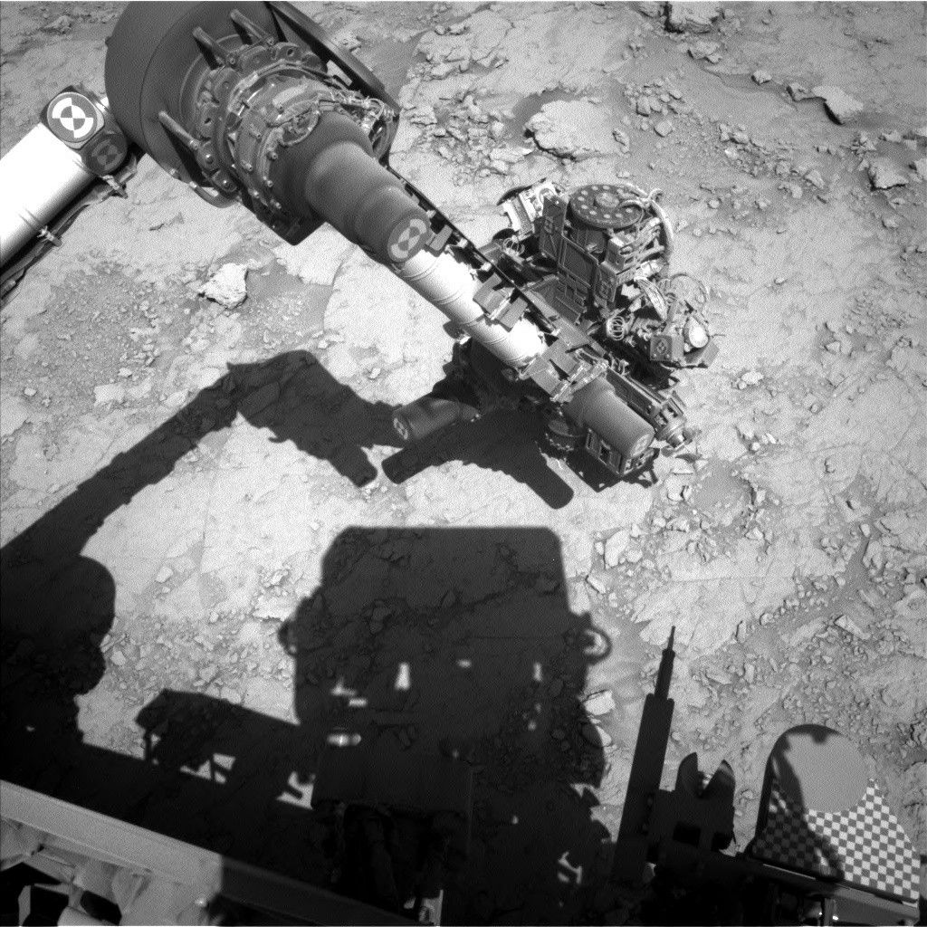
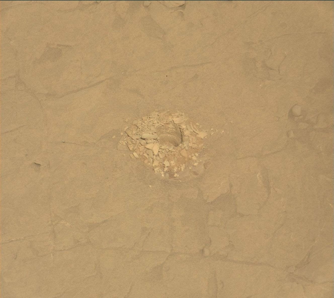
As we near the end of our Altadena drill campaign, Curiosity continued her exploration of the Martian bedrock within the boxwork structures on Mount Sharp. After successfully delivering a powdered rock sample to both the CheMin (Chemistry and Mineralogy) and SAM (Sample Analysis at Mars) instruments, the focus for sols 4568 and 4569 was to take a closer look at the drill hole itself — specifically, the interior walls of the drill hole and the associated tailings (the rock material pushed out by the drill).
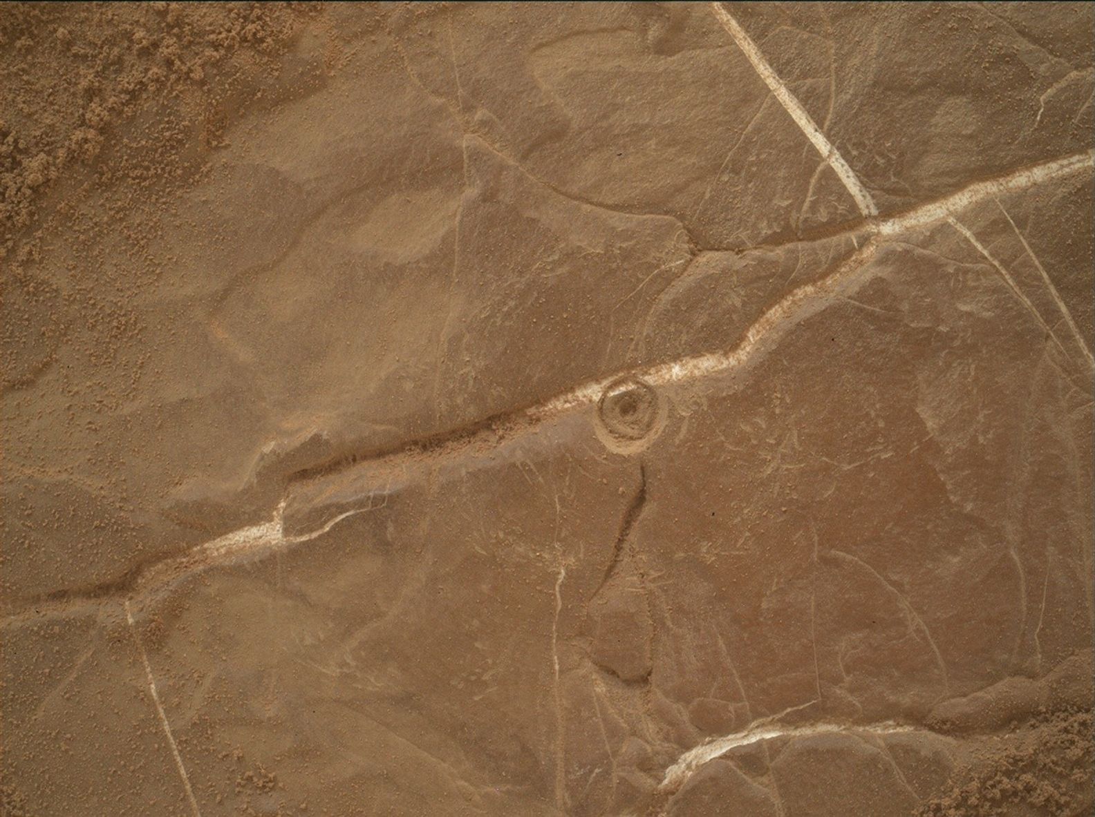
In the image above, you can see that the tone (or color) of the rock exposed within the wall of the drill hole appears to change slightly with depth, and the drill tailings are a mixture of fine powder and more solid clumps. If you compare the Altadena drill site with the 42 drill sites that came before, one can really appreciate the impressive range of colors, textures, and grain sizes in the rocks that Curiosity has analyzed over the past 12 years. Every drill hole marks a window into the past and can help us understand how the ancient environment and climate on Mars evolved over time.
In this two-sol plan, the ChemCam, Mastcam, APXS, and MAHLI instruments coordinated their observations to image and characterize the chemistry of the wall of the drill hole and tailings before we drive away from this site over the coming weekend. Outside of our immediate workspace, Mastcam created two stereo mosaics that will image the boxwork structures nearby as well as the layers within Texoli butte. ChemCam assembled three long-distance RMI images that will help assess the layers at the base of the “Mishe Mokwa” hill, complete the imaging of the nearby boxwork structures, and image the very distant crater rim (about 90 kilometers, or 56 miles away) and sky to investigate the scattering properties of the atmosphere. The environmental theme group included observations that will measure the properties of the atmosphere and also included a dust-devil survey.
.JPG?w=1024&h=512&fit=clip&crop=faces%2Cfocalpoint)